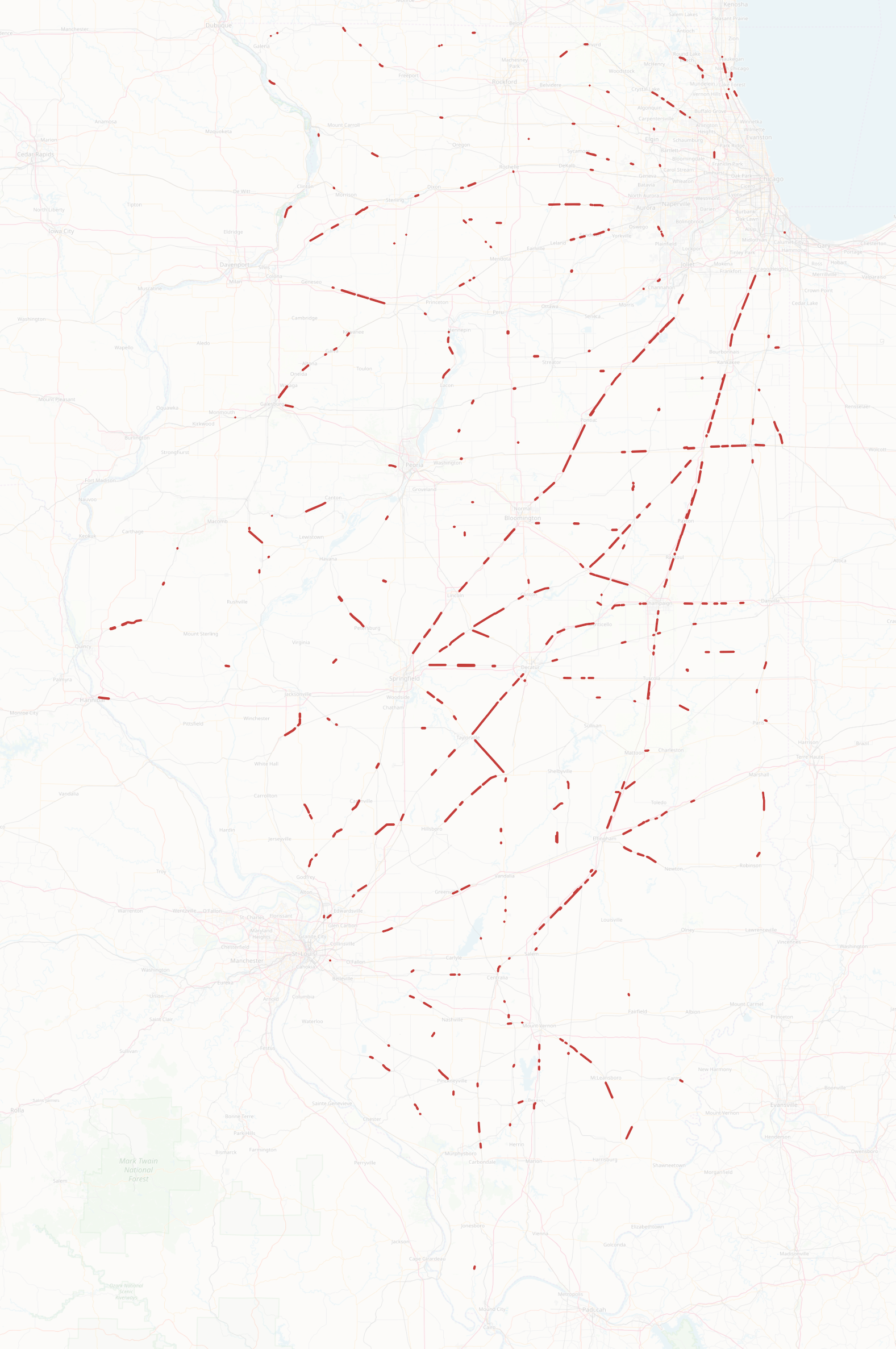
IDOT Prairie Inventory Reports
Between 2001 and 2003 IDOT (The Illinois Department of Transportation) conducted a survey of prairie remnants where a rail line and road were within 500 feet of each other. The map files and surveys are available on the "Prairie Inventory" tab here:
https://idot.illinois.gov/transportation-system/environment/roadside-maintenance
If you're traveling through an area I have found that checking out some of these narrow remnants can be well worth a stop. Many of them are much larger in person than they appear from satellite imagery. A few of these are now protected as nature preserves but there are also some with no protection that I know of that I haven't seen marked anywhere else. Check it out!


Σχόλια
I've extracted the shapefiles for the GIS inclined, they can be obtained from here: https://github.com/bingaman/roadside-prairie
Seems like it would be a bigger deal that IDOT owns almost 200 miles of linear remnant prairies but what do I know?
The map misses remnant prairie south of I55 and north of Santa Fe RR between Cicero and Harlem. Years ago compass plants were invading the interstate ROW from the remaining remnant.
Προσθήκη σχόλιου